![]()
![]()
![]()
Use LEFT and RIGHT arrow keys to navigate between flashcards;
Use UP and DOWN arrow keys to flip the card;
H to show hint;
A reads text to speech;
31 Cards in this Set
- Front
- Back
|
Basin and Range |
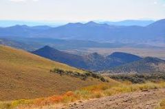
located west of the Rocky Mountains and contains varying elevations with isolated mountain ranges
|
|
|
Great Plains |
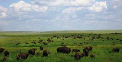
located west of the Interior Lowlands and contains flat lands that gradually increase in elevation westward |
|
|
Coastal Range |
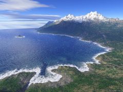
has rugged mountains along the Pacific Coast that stretch from California to Canada
|
|
|
Rocky Mountains |
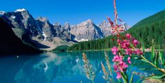
located west of the Great Plains and contains the Continental Divide and rugged mountains that stretch from Alaska to almost Mexico
|
|
|
Appalachian Highlands |
located west of the Coastal Plain extending from eastern Canada to western Alabama and contains old eroded mountains |
|
|
Interior Lowlands |
located west of the Appalachian Mountains and contains rolling flatlands, many rivers, broad river valleys, and grassy hills? |
|
|
Coastal Plains |
located along the Atlantic Ocean and the Gulf of Mexico and provides many excellent harbors |
|
|
Canadian Sheild |
wrapped around the Hudson Bay in a horseshoe shape that contains 100's of lakes carved by glaciers |
|
|
Atlantic Ocean |
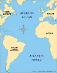
served as an early highway for explorers, early settlers, and immigrants |
|
|
St.Lawrence River |
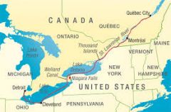
forms the northeastern border with Canada (also connects great lakes to ocean) |
|
|
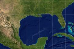
Gulf of Mexico |
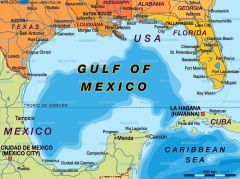
provided the French and Spanish with an exploration routeto Mexico and America
|
|
|
Rio Grande River |
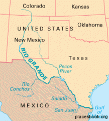
forms the border between Mexico and USA
|
|
|
Colorado River |
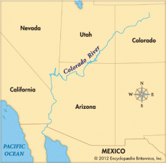
was explored by the Spanish
|
|
|
Columbia River |
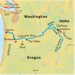
was explored by Lewis and Clark |
|
|
Ohio River |
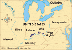
known as "The Gateway to the West"
|
|
|
Mississippi River |
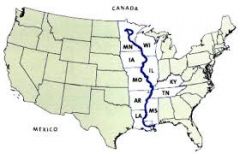
was used to transport farm and industrial products and is the most famous river |
|
|
Pacific Ocean
|
was an early exploration destination |
|
|
Missouri River |
was also used to transport farm and industry products and is the longest river
|
|
|
Great Lakes: Huron Ontario Michigan Erie Superior |
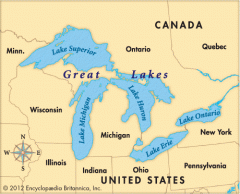
Inland port cities grew in the midwest along these
|
|
|
Lake |
A large inland body of water |
|
|
River |
A large natural stream of water |
|
|
Tributary |
A smaller stream that flows into a river/ocean/lake |
|
|
Gulf |
A large area of sea or ocean partially enclosed by land |
|
|
Bay |
A body of water partially enclosed by land |
|
|
Mountain |
A natural elevation of the earth's surface having considerable mass |
|
|
Hill |
A well-defined natural elevation smaller than a mountain |
|
|
Plain |
A large relatively flat area of land |
|
|
What is a plateau? Land or water? |
A large ,relatively flat, but elevated area of land Land |
|
|
What is an island? Land or water? |
A land mass- smaller than a continent -surrounded by water Land |
|
|
What is a peninsula? Land or water? |
A piece of land that projects into a body of water and is connected with the mainland Land |
|
|
What are geographic features related to? |
Locations of cities and towns, patterns of trade, westward movement, and agricultural and fishing industries |