![]()
![]()
![]()
Use LEFT and RIGHT arrow keys to navigate between flashcards;
Use UP and DOWN arrow keys to flip the card;
H to show hint;
A reads text to speech;
26 Cards in this Set
- Front
- Back
|
geography |
the study of the interaction of all physical and human phenomena at individual places and of how interactions among places form patterns and organize larger spaces.(The study of the earth) |
|
|
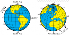
latitude |
the angular distance measured north and south of the equator.Latitude varies from 0° at the equator to 90° at the North and South Poles. |
|
|
longitude |
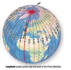
the angular distance measured east and west on Earth’s surface. Longitude is also measured in degrees, minutes, and seconds. It is represented by imaginary lines, called meridians, extending from pole to pole and crossing all parallels at right angles. Meridians are not parallel to one another. They are farthest apart at the equator, become increasingly close northward and southward, and converge at the poles. |
|
|
absolute location
|
describes the location of a place based on a fixed point on earth. The most common way is to identify the location using coordinates such as latitude and longitude. Lines of longitude and latitude crisscross the earth. |
|
|
Continents |
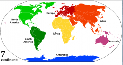
Asia, Africa, North America, South America, Antarctica, Europe, and Oceania |
|
|
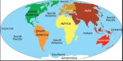
Oceans |
|
|
|
Nile |
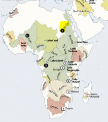
Africa |
|
|
Amazon |
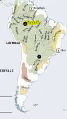
South America |
|
|
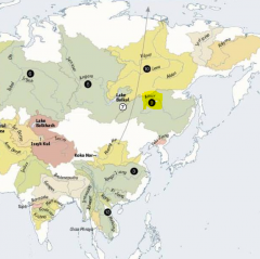
Yangzi jiang |
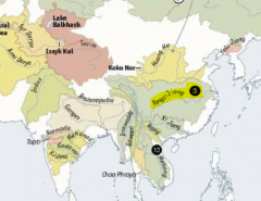
Asia |
|
|
Mississippi |
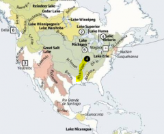
North America |
|
|
Jenissei-Angara |
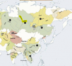
Asia |
|
|
Ob-Irtych |
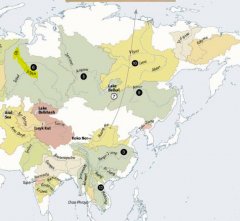
Asia |
|
|
Parana |
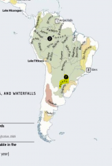
South America |
|
|
Congo |
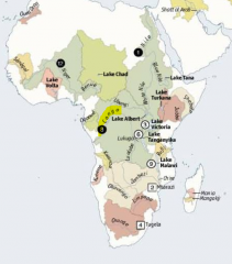
Africa |
|
|
Amur |
Asia |
|
|
Lena |
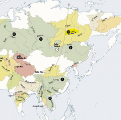
Asia |
|
|
Mackenzie |
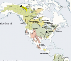
North America |
|
|
Niger |
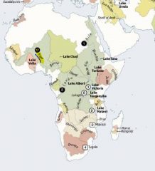
Africa |
|
|
Mekong |
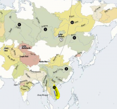
Asia |
|
|
Volga |
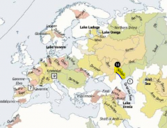
Europe |
|
|
Murray-Darling |
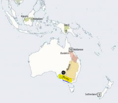
Oceania |
|
|
Equator
|
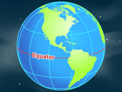
an imaginary line on the Earth's surface equidistant from the North Pole and South Pole, dividing the Earth into the Northern Hemisphere and Southern Hemisphere.
|
|
|
Prime meridian |
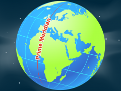
meridian in a geographical coordinate system at which longitude is defined to be 0°. Together, a prime meridian and its antimeridian form a great circle |
|
|
International Date Line |
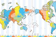
(IDL) is an imaginary line of longitude on the Earth's surface located at about 180 degrees east (or west) of the Greenwich Meridian. |
|
|
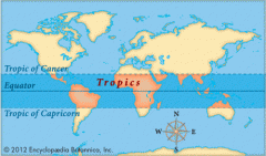
tropics |
|
|
|
latitude and longitude of the Arctic Circle |
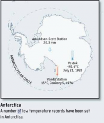
is the parallel of latitude that runs 66° 33´ 39" (or 66.56083°) north of the Equator and is one of the five major circles of latitude that mark maps of the Earth. Everything north of this circle is known as the Arctic, and the zone just to the south of this circle is the Northern Temperate Zone. |